

Lower Hackberry Canyon is a short, easy canyon hike through clear, ankle-deep water. This is a great hike to do especially in the late Spring or early Summer, as you have the shallow stream keeping you cool. During dry summers, the stream may disappear, so keep that in mind when planning for this hike. This trip report will only cover the first 1.5 miles into Lower Hackberry Canyon. While one can continue up Hackberry Canyon to Frank Watson’s old cabin and Sam Pollock Arch, the part described here is the easiest and most scenic of Hackberry Canyon. Although the trailhead is located right off of the graded Cottonwood Canyon Road, it takes a fair amount of time to arrive at the Lower Hackberry trailhead depending on the road conditions.
Lower Hackberry Canyon
Distance – 3.0 miles roundtrip
Approximate hiking time – 2 to 3 hours
Elevation at Trailhead – 4770 feet
Elevation in Lower Hackberry Canyon – 4786 feet
Elevation at turnaround point – 4868 feet
Difficulty – Easy
Trail – Sand, water
Amount of water recommended – 3 liters
Bathrooms – None
Season to hike – Year around
Prone to flash floods? – Yes, can be prone to flash floods.
Permits – N/A
Pets: Permitted, preferably on a leash
How to get there:
If coming from the south via US-89, head east out of Kanab for 46.2 miles, where you will turn left onto the dirt Cottonwood Canyon Road. If coming from Page, Arizona, set your odometer to 0 after crossing the Glen Canyon Dam. Travel west on US-89 for 25 miles. Turn right onto Cottonwood Canyon Road. After turning onto Cottonwood Canyon Road, follow it 14.6 miles until you will see a sign for Lower Hackberry Canyon. Turn left into a small loop parking area. The hike will start here.
If coming from the north from Kodachrome State Park, turn left (east) down the dirt Cottonwood Canyon Road and continue for 24.3 miles until you reach the Lower Hackberry Canyon sign. Turn right into the small loop parking area. FYI, the drive from Kodachrome State Park to Lower Hackberry will take about 90 minutes. *See the Google Map for this hike at the end of this post.
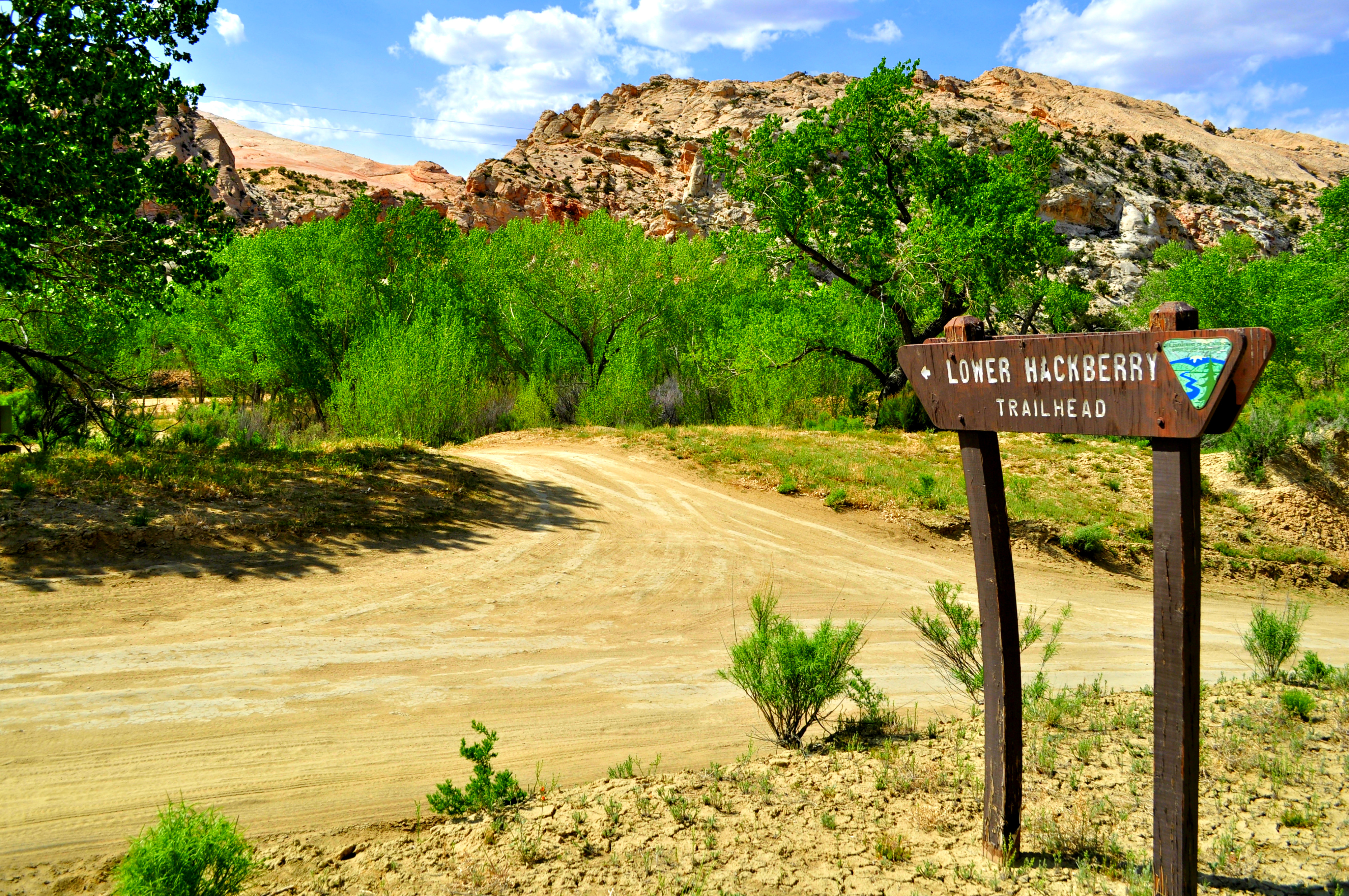
Luckily, the trailhead sign makes Lower Hackberry Canyon hard to miss
Hitting the Trail!
As you leave the parking area, you’ll see a trail register. From the trail register, head west down a small sandy trail to the streambed. You have two options. You can follow the streambed north (right) and it will begin to curve around to the west after about a quarter of a mile, or you can cross the streambed and continue west, heading toward the mouth of Hackberry Canyon. You’ll walk through some cottonwood and box elder trees as well as dry sand as you make your way to the mouth of the canyon. Whether you follow the streambed around or cross the streambed and continue west, both options will take to the start of Lower Hackberry Canyon.
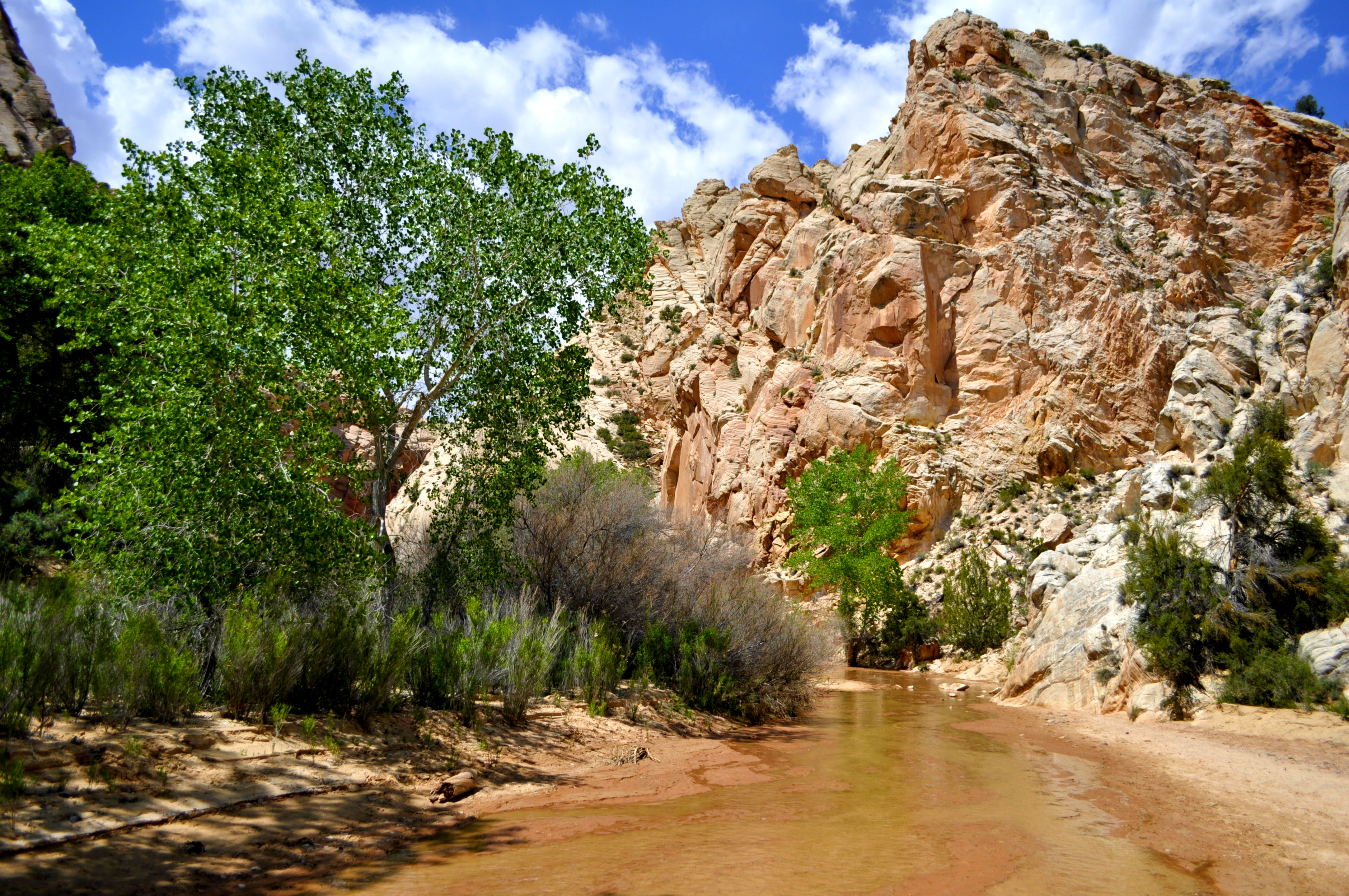
Hiking through the shallow, clear stream makes the hike even better
Late April or mid May are great times to hike Hackberry Canyon. The water is nice and cool, and the temperatures are perfect for a hike through the shallow stream. What makes this hike special is the clear, shallow stream that you get to walk through. I would highly recommend wearing water shoes, or just go barefoot. That’s right. The water and sand are so nice that walking barefoot is rather enjoyable. Unfortunately, when Hackberry Creek runs dry, the hike is a hot one has a completely different feel from when it has water.

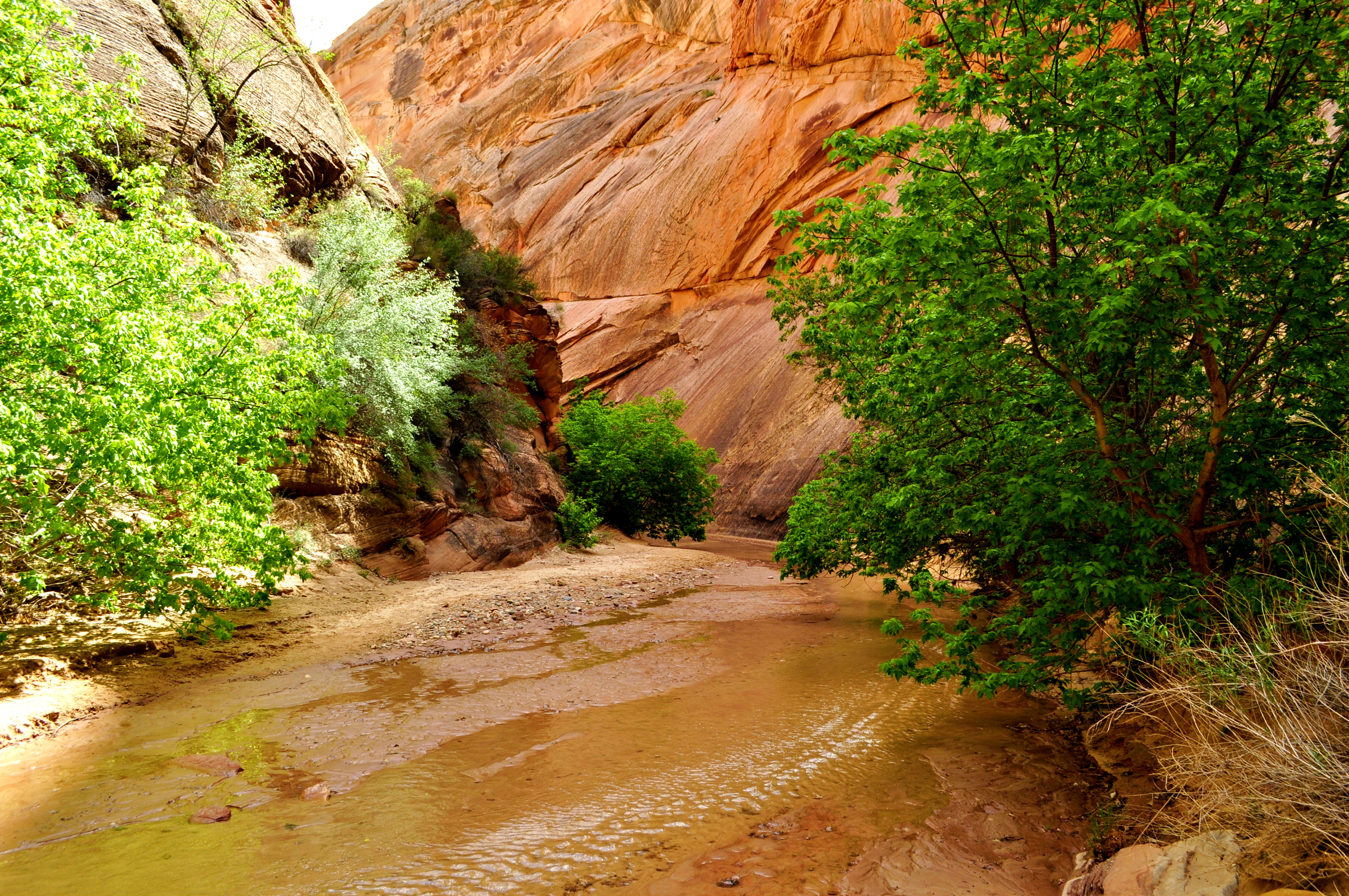
One of the most scenic parts of Hackberry Canyon
As you make your way up the the canyon for about 1.5 miles, the canyon will start to widen and head north. At this point you’ll be completely exposed to the sun if you decide to continue up the canyon. This is where I would recommend turning around and heading back.

It was a beautiful day for a hike.
Some hikers choose to continue up the wide canyon another 3 miles to the old cabin of Frank Watson. It is located on the west side of Hackberry Canyon, about 15 feet above the streambed. The cabin is about 0.6 miles south of Sam Polloch Canyon which comes in from the west. One can continue up Sam Polloch Canyon for 1.6 miles and see Sam Polloch Arch. It can be a challenging hike up to the arch due to boulders that are strewn along the bottom of the canyon that require a lot of scrambling.
After you’ve reached the turnaround point be sure to take pictures on the way back as well, as the lighting and scenery can change on your return to the trailhead.
For upcoming hiking and survival posts, follow the Your Hike Guide Facebook page!
The green foliage really makes the background pop
This is a hike that can be completed in just a couple of hours and can be combined with Yellow Rock, Cottonwood Canyon Narrows, or Grosvenor Arch.
For this hike, I recommend wearing lightweight shoes with good traction and water drainage. My favorite is the Keen Class 5 Tech shoe, and my wife wears Keen Newport H2 Sandals.

For more of our favorite hiking trails, connect with Your Hike Guide on Instagram and Facebook!

Download for FREE
Disclaimer: The information that we give on any hiking trail is for informational purposes only. The trail description is given to give the reader a better understanding of what to expect while visiting the hiking trail. This information is not intended to give specific advice on any trail. The writer and/or publisher of this website is not responsible for any accidents, injuries, rescues, inconvenience, or loss of life by anyone attempting any of the hikes on this website
Although every attempt has been made to verify the accuracy of any trail information, it is the responsibility of the reader to use common sense and good judgment by interpreting and using the information to safely enjoy any outdoor activities. Hiking can be dangerous and has many potential hazards. It is up to each individual to know their limits and level of expertise before attempting any outdoor activity.
Adam’s Favorite Gear:


1 Comment
Pingback: Best Women's Hiking Shoes - Your Hike Guide