

Red Cliffs Recreation Area often gets overlooked since it is surrounded by the grander Zion National Park, Cedar Breaks National Monument, and Snow Canyon State Park. However, it is a great place for a family to spend to a couple of hours. The best and most popular hike in Red Cliffs Recreation Area is the Red Reef Trail, although there are other short hikes with the recreation area.
Red Reef Hike Details
Distance – 1.5 miles roundtrip
Approximate hiking time – 1 to 2 hours
Elevation at Trailhead – 3220 feet
Elevation at Moki steps – 3305 feet
Difficulty – Easy to the first pools. Medium to walk the Moki steps,
Trail – Packed sand, creek bed, sandstone. Little shade for the first 0.5 miles.
Amount of water recommended – 3 liters
Bathrooms – Yes, in the Red Cliffs Campground
Season to hike – March to November, Spring and Fall are best
Prone to flash floods? – Yes, can be prone to flash floods. Check the weather report.
How to get there:
From Salt Lake City, Utah, take I-15 South. Take the Leeds exit, Exit 23. Turn left (southeast) and go under over I-15. Take your first right which will be Main St. (Old Hwy 91) This road will run parallel to I-15 for five miles. Just before the five miles you’ll see a sign that says Red Cliffs Recreation Area and Red Cliffs National Conservation Area with arrows pointing right. Turn right onto a narrow road that will go under I-15. It is a narrow and short underpass of sorts. After you go under I-15 the road ends at a “T” intersection. Turn left here, staying on the paved road. In 0.3 miles the road will curve to the right and take you to the Ranger station. As of May 2017, it is $5 dollar fee to the use the recreation area that is paid at a self-pay station near the entrance of the campground.
Hitting the Trail!
Parking in the Red Cliffs Recreation Area is limited, and fills quickly early on the weekends, especially in the Spring and Fall. The largest lot with about 30 spaces is accessible after driving through the Red Cliffs campground loop road.
A map of the Red Cliffs Recreation Area is handed out a the ranger booth that outlines all the hikes in the area. The start of the Red Reef Trail hike starts at the at the northwest corner of the campground, just off the road and is easy to spot.
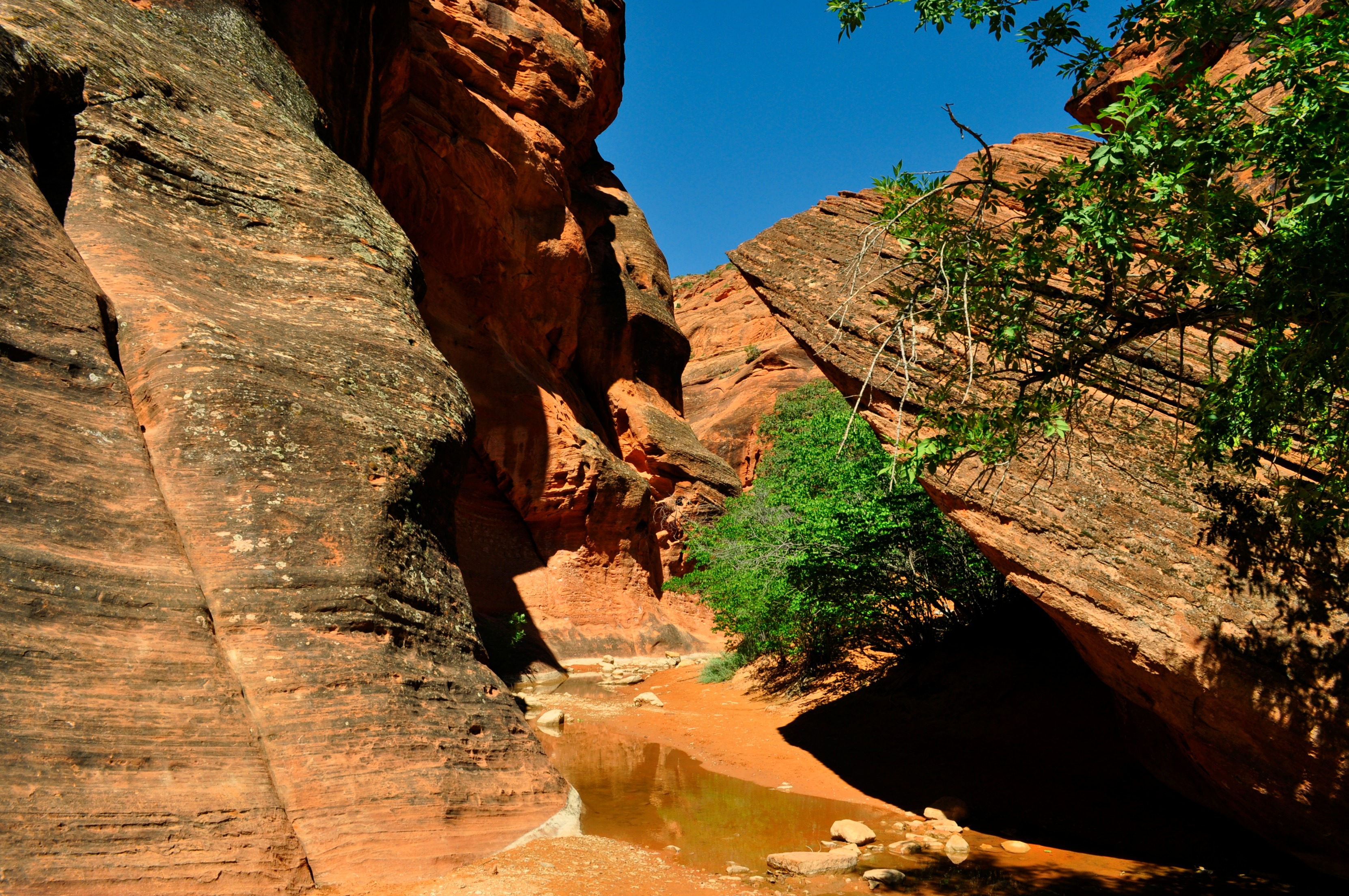
This hike is the most popular hike in the Red Cliffs area and sees hundreds of people each weekend. The hike roughly follows Quail Creek into Water Canyon, and typically dries up during the hotter, summer months, but runs during the Spring and can be prone to flash floods, so as with any type of canyon hike, check the weather reports.

The first part of the hike crosses through an open area as it dips down and crosses over a couple of small dry creek beds. It’s an easy trail to follow for all hikers and families. It is a hike that most young children, pregnant mothers, and senior citizens can do without problems. In the Spring, it is common to see some wading pools along the trail, and can provide great fun for hikers. Jumping and diving into any pool is not recommended and is done at their own risk. Also, during the Spring, small runoff cascades can be flowing through the canyon.
There is a part of the hike where the trail splits and it seemed to cause some confusion with the hikers. Shortly after the trail drops into the stream bed, you can continue straight to the first pool, or you can follow a trail sign that heads off to the left and out of the stream bed. This is the correct path to take.

A lot of hikers miss this narrow trail sign and head right up the stream bed instead of taking a left.
After about .75 miles you’ll arrive at the small cascade and deep pothole pool that you may recognize as the signature photo of Red Cliffs. The small cascade is normally dry or just a trickle most of the year, but once again, during the early Spring, the cascade is the most robust. This is the turnaround point for most families with small children or grandparents. It’s a nice shady spot to relax before heading back.
There are moki steps carved into the sandstone to the right of the pool and cascade. Typically there are two ropes anchored to the rock above the steps to help provide balance to hikers using the moki steps. Please note that the ropes can be frayed and in poor condition, so make sure you look them over before using them. The ropes are more for balancing and not climbing. It is not overly dangerous, but it is something that I do not recommend for young children, or older adults. It does require balance and good footwork to put each foot into the “steps” carved into the sandstone. If you use the ropes, be courteous and make sure that they can be reached by the next hikers.

To the right, are moki steps which are hand and foot holds that have been carved into the soft sandstone to aid hikers in getting around the main runoff on the Red Reef trail.
Beyond the runoff and the moki steps is my favorite part, especially when there is some running water in the canyon. The red canyon walls mixed with green cottonwoods, make for great contrast in your pictures. Also, if there is some flowing water, it allows for some good reflection pictures. As you proceed farther up the canyon, it will narrow up into a chute. Water has always been here when I’ve visited the area, and it ranges from ankle deep to chest deep and higher.
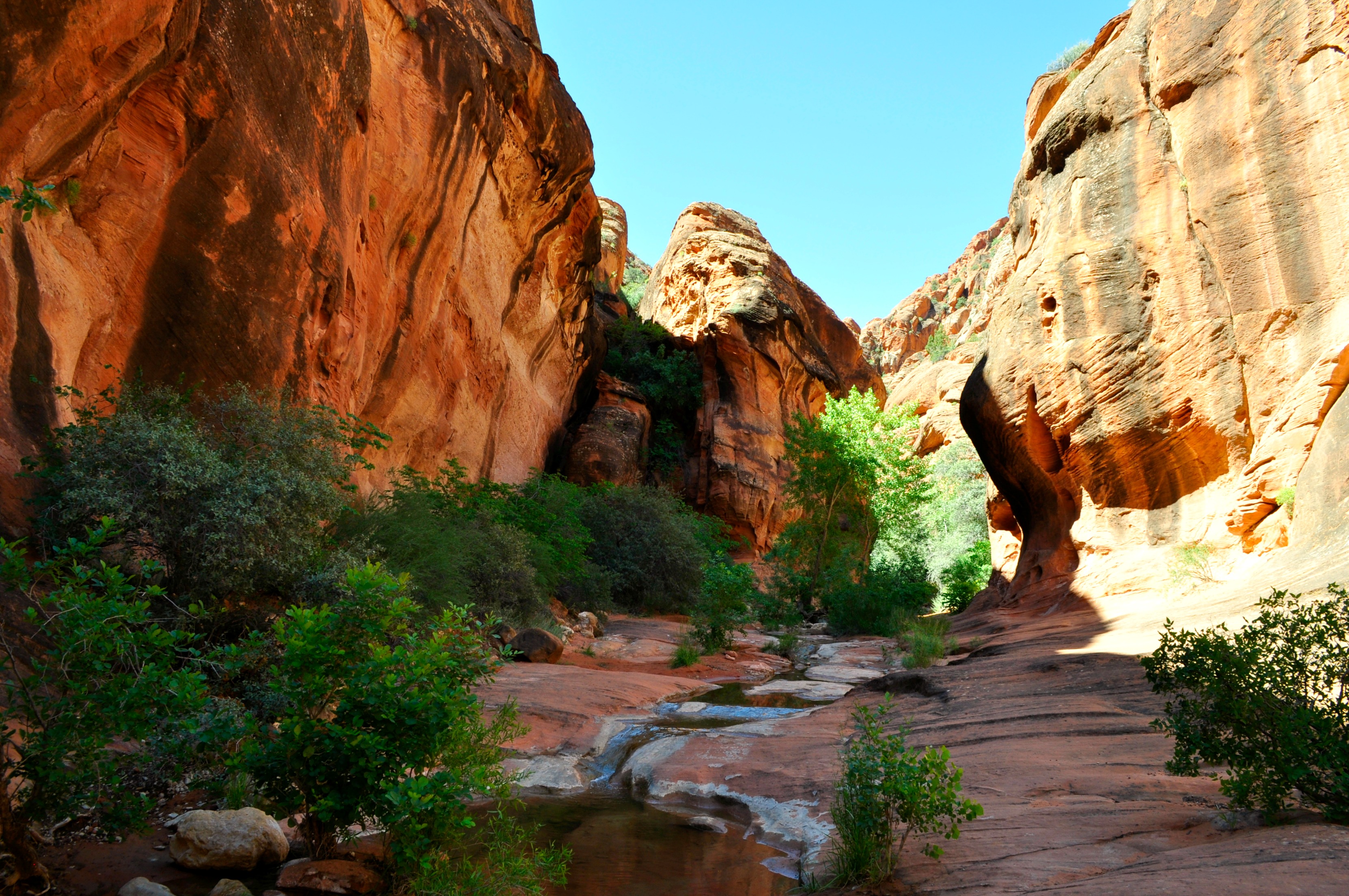
Just above the moki steps hikers are rewarded with great colors.

Thiis is the narrowest chute in the canyon. The water here can range from ankle deep to up to neck deep. This narrow chute will lead to at least one dryfall or waterfall, depending on the time of season.
There are a couple of 6-8 foot dryfalls, or waterfalls, depending on the season, that can be a little challenging to bypass. Most of the hikers that get to this spot, take a break here. They have a snack or lunch, then turn around and head back to the trailhead. There are some hikers that continue up the canyon, as it goes for another couple of miles. However, hikers have seen the best the canyon has to offer at this point of the hike.
Be sure to take plenty of pictures, landscape, portrait, and square, as the light in a canyon is constantly changing the composition of your photographs.
We’d love to meet you! Connect with us at Your Hike Guide on Instagram or Facebook


