

Devils Garden is located in Arches National Park, right outside Moab, Utah. Devils Garden is also the home of the longest arch in world, Landscape Arch. The high concentration of arches in this small area make it a spectacular hike. Whether you’re a beginning hiker, or a seasoned veteran, everyone will enjoy Devils Garden!

Devils Garden Hike Details
Distance – About 2.2 miles roundtrip to Landscape Arch and other arches along the trail, 5.8 miles roundtrip to Double O Arch including all side trails, 8.9 miles roundtrip if taking the Devils Garden Primitive Loop back to Landscape Arch
Approximate hiking time – 1.5 to 2.5 hours
Elevation at trailhead – 5117 feet
Elevation at highest point – 5521 feet
Elevation gain – 404 feet
Difficulty – The first part to Landscape Arch is easy, the next mile to Double O Arch is moderate.
Trail – well maintained, dirt, gravel, and slickrock
Amount of water recommended – 2 to 3 liters, there is no shade
Bathrooms – Yes, located at trailhead
Seasons to hike – Late February to late November, best time to hike it is April, May, and October due to heat in summer
Permits needed – $10 park entrance fee
Pets allowed – No pets
How to get there:
Arches National Park is located five miles north of Moab, Utah, along US-191. Upon entering the park, rangers will give you a park map. Follow the park road for 18 miles to end of the road, where you will see signs for Devils Garden parking area. While there is a lot of parking, the spots will all be filled by mid-morning, so get there early to find a place to park.
Hitting the Trail!
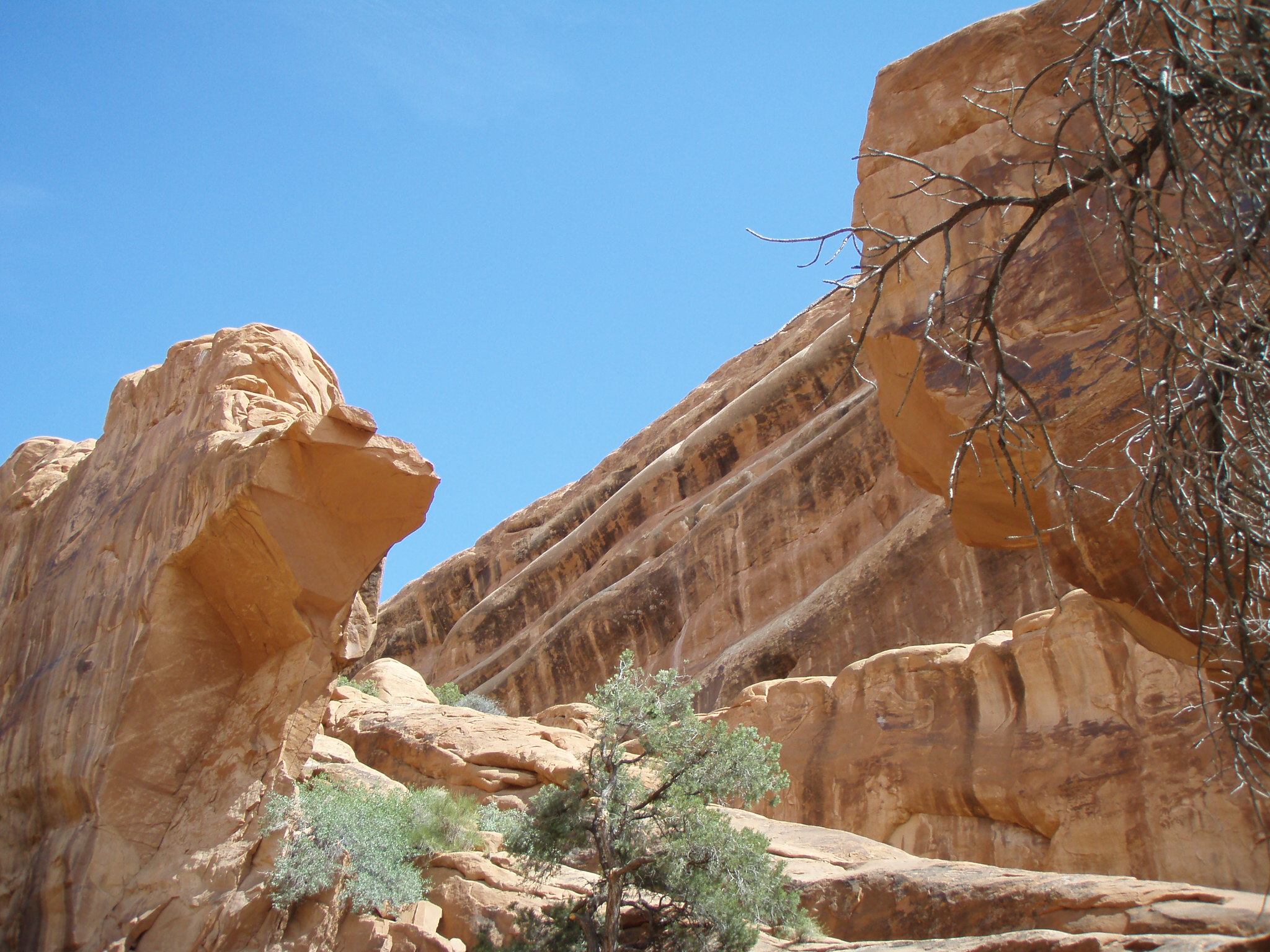
The trail in Devils Garden is well-used and well-marked, with signs pointing out each significant arch along the way. As you leave the parking lot, you’ll immediately find sandstone fins soaring on either side of you. After about 0.2 miles it opens up and the first of several side trails begin.
You will see signs for Pine Tree Arch and Tunnel Arch, both of which are 0.1 miles each, (0.2 miles roundtrip for each) and only takes an extra ten minutes to see each one.

Tunnel Arch pictured in early March

Pine Tree Arch is located right off the main trail in Devils Garden
After returning to the main trail you’ll continue for 0.5 miles on the flat, wide trail, until you come to this sign. Stay on the main trail which is to the left. The trail to the right marks the end of the return loop for the primitive trail, which starts about two miles farther up the Devils Garden trail. Well, discuss this trail more a little later in this article.
You’re bound to see a lot of other hikers from all over the world visiting Arches National Park, which is evident from the collection of different languages you’ll hear along the trail.
While there are over 2,000 arches in Arches National Park, one of the most famous is Landscape Arch, which can be seen from a distance. If you look ahead on the left side of the trail, and have a sharp eye, you’ll spot Landscape Arch. This arch is considered the longest natural arch in the world. With a span of nearly 300 feet, it narrowly edges out Kolob Arch found in Zion National Park. As you get closer to Landscape Arch, you’ll marvel at not only the span of the arch, but also how fragile it looks. The best time to photograph the arch is mid-morning, but let’s be honest, it’s an impressive sight at any time during the day.

Landscape Arch is the longest natural arch in the world, measuring just over 290 feet across.
In September 1991, while visitors were relaxing under Landscape Arch, they heard what they thought was the distant rumble of thunder, then small fragments of rock tumbled from up above, the hikers scattered as a 60 feet long slab of rock from the right side of the arch, weighing 180 tons fell from Landscape Arch. That fall prompted the park service to close the trail that went under the arch. Since then, there have been other rock slabs measuring 30 feet long and 47 feet long, giving Landscape Arch it’s fragile appearance. The right part of the arch is only six feet thick at it’s thinnest point. Landscape Arch, which has experts thinking that it may not have much time left. The closest arch to Landscape Arch, Wall Arch, while not having the large span of it’s neighbor looked much more sturdy and stable than fragile Landscape Arch. However, sometime during the night of August 4th and the morning of August 5th, 2008, Wall Arch collapsed. Here are before and after photos of Wall Arch.

Wall Arch before it collapsed between the night of August 4th, and the morning of August 5th, 2008
This is Wall Arch as seen now.
By the time you’ve visited Tunnel Arch, Pine Tree Arch, and Landscape Arch, you will have hiked 1.2 miles. Many hikers who have limited time tend to turn around at Landscape Arch and head back to the trailhead, while some turn back as the next section of the hike is a little more strenuous, especially for young children and the elderly, as you will be walking along the top of a rock fin to get to the next set of arches. It’s nothing too difficult, it can just be a little tiring for some.
After reaching the top of the fin that passes the collapsed Wall Arch, the trail flattens out and you come to your next set of side trails. These lead to Navajo Arch and Partition Arch. These side trails are 0.3 miles past Landscape Arch. The side trail to these arches are clearly marked on the left side of the main trail. The short side trip to each arch is only 0.2 miles, (0.4 miles roundtrip for each arch.) and is well worth it.
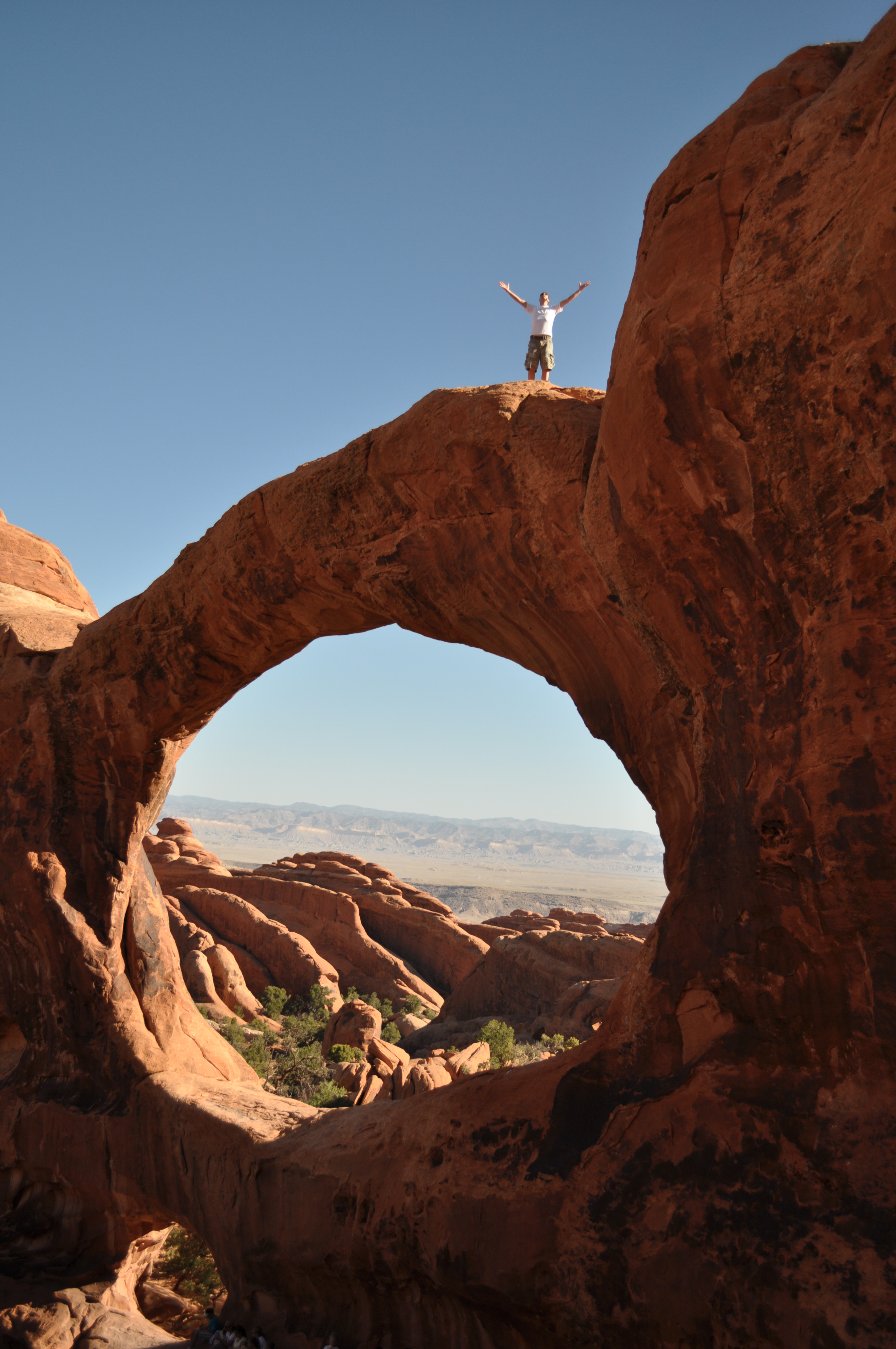
Partition Arch is a fun arch because it consists of a large and a small arch next to each other. Hikers can actually sit in the smaller arch. This is a very picturesque arch due to the vast desert background seen through the arches.

Partition Arch offers impressive views of the landscape around Arches National Park

The author taking a breather in the small arch at Partition Arch
The trip to and from Partition Arch is well worth the 0.4 miles roundtrip visit, and is one of my top five arches in the Park. After visiting Partition Arch, the other side trail to Navajo Arch is the same distance. Navajo Arch is considered a “young” arch by geologists. Due to the location of the arch at the bottom of a rock fin, it has potential to become a much larger arch with all the rock above Navajo Arch.

The best pictures of Navajo Arch come after you’ve walked under the arch and shoot it with the pine trees framed in the opening.
After returning to the main trail, you will continue another 0.8 miles to Double O Arch. Along the way, you will need to traverse along the top of a narrow rock fin for about 100 meters. It isn’t too bad, but this may be a place where children could feel apprehensive, due to height. After crossing the fin, you’ll have a nice overlook of the desert landscape to the northeast. The dark arch in the distance is Black Cave Arch.

This is a beautiful overlook of countless sandstone fins. Black Cave Arch is in the distance
After passing the overlook it’s just a short distance to Double O Arch. It is composed of two arches just like Partition Arch, however with Double O Arch, a large arch is on top of a small arch. The best photographs of these arches come after climbing through the bottom arch and walking up and behind them and trying to squeeze both into the frame.
Another interesting tidbit about Double O Arch is that some daring hikers scramble to the top of the upper arch of Double O Arch, about 90 feet off the ground. I don’t know the legality of this, but I’ve seen pictures of people up there. I would not recommend trying it, since it is kind of sketchy to get on top of the arch. The views of the arch are better from the ground anyway.

Taken from the backside of Double O Arch
The author on top of Double O Arch
After taking pictures at Double O Arch, you will have hiked a total of 3.2 miles, including all the side trails to the other arches. From here you have a couple of decisions. 1) You can turn around and head back the way you came, which will be 1.9 miles since you won’t be hitting the side trails on the way back. 2) You can continue for another 0.4 miles (0.8 miles roundtrip) to a rock spire called Dark Angel. The trail ends at Dark Angel, so to return to the parking area you can retrace your steps back to Double O Arch, return the way you came, or your third option is to take the Primitive trail for 2.7 miles back to where we saw the sign for it near Landscape Arch. I’ve done the Primitive trail once, just so I could see what was out there, and so I could say that I did it. It wasn’t nearly as exciting as the main trail. There is only one arch that you can get to on the trail. Most of the Primitive trail is through sandy washes and along fins. There wasn’t a lot to see. Not many people take the Primitive trail, hence the name. I imagine that it can be a pretty miserable hike in the summer since there will be little shade, and you’ll be slogging through sand.

Private Arch is located on a side trail of the Primitive trail

This is one of the best pictures along the Primitive trail.
Devils Garden is one of those hikes that I encourage anyone visiting Utah to do. I remember that I was afraid Landscape Arch was going to collapse before I got to see it. I love this hike. Devils Garden is easy and very rewarding. I do this hike once or twice a year, each time taking friends that have never been, and I’m never tired of it.
For upcoming hiking and survival posts, follow the Your Hike Guide Facebook page!


